
Three Good Questions
This is the fourth in an ongoing series of posts about historical research, featuring news articles, adverts, and other sources mostly from Britain in the 19th century.
Just for fun, imagine you stumbled across the article reproduced below during your research. What could you learn from it? How many research rabbit holes would it lead you down? In what new directions might it take your writing?
If you interrogate the images and words closely, what Three Good Questions would you want answers to first? You can send me your suggestions via the form at the bottom of the page.
I’ll collate the questions, and begin to answer some of them, in a follow-up post. Subscribers to the ThreesWrite Newsletter will receive that before it’s published on the website.
Here are my first Three Good Questions:
- Who built the three fortresses (and are they still standing)?
- Who was Captain G.H. Ware?
- What were the 51st Light Infantry doing in that region at the time?
Illustrated London News (4th February 1865)
SCENERY OF CASHMERE AND THE UPPER INDUS
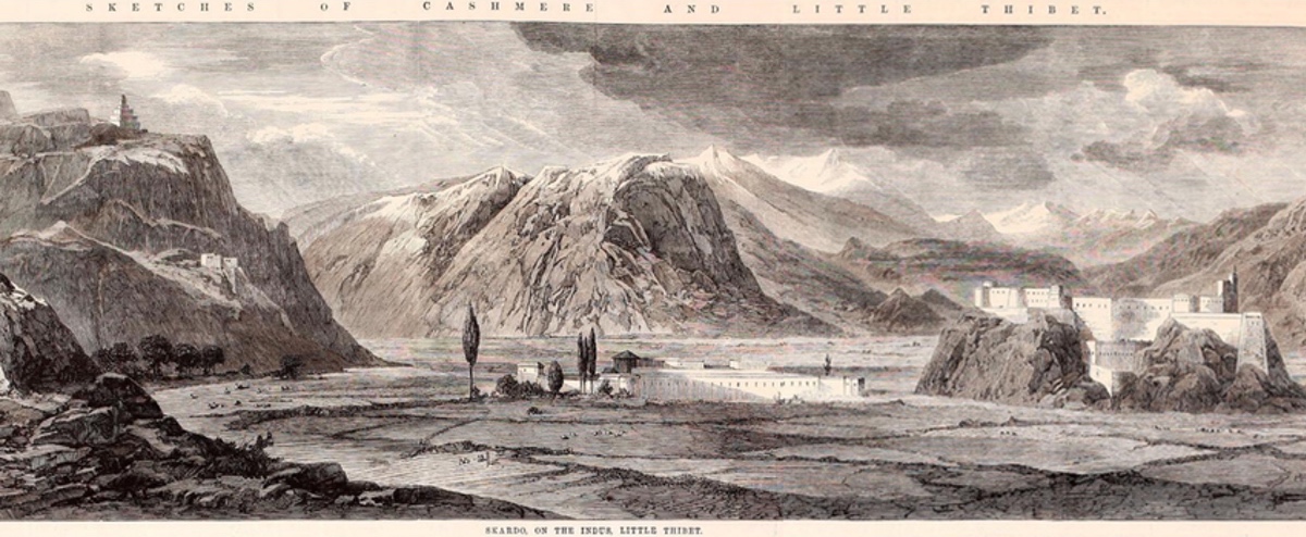
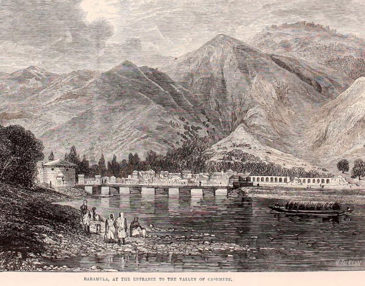
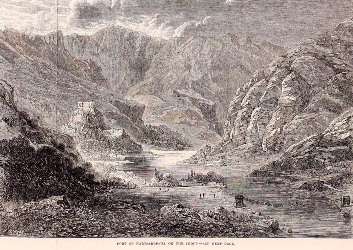
The territory of Cashmere, to the north of the British province of the Punjaub, is almost quite shut in by lofty mountains — secondary ranges of the Himalayas — the summits of which are covered with perpetual snow. Its principal outlet is the Baramula Pass, by which the river Jailum or Behut (the ancient Hydaspes), which drains the whole of the inclosed basin and is navigable for light vessels, emerges into the vast plain of the Punjaub, to join the Sutlej and other rivers there, which discharge themselves into the Indus. We are indebted to Captain G. H. Ware, of the 51st Light Infantry, for a sketch of the Baramula Pass; as well as for two views of the scenery of the Upper Indus, in Little Thibet: the larger one represents the village of Skardo, or Iskardo, the capital of a little State called Bulti, on the frontier of the Chinese empire. Here is a large fortified building perched upon a rock overlooking the River Indus, with cultivated ground on one side, and a desert of white sand on the other; a second fortress, with a few houses about it, lies beneath; and snowy mountains, with glaciers far surpassing those of the Alps, surround the place on every hand. Another illustration gives a view of the fort of Kartsabrusha on the Upper Indus.
Source: Illustrated London News (4th February 1865)


